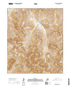
2017 Map of Solomon D-5 SE
USGS Topo · Published 2017About this map
Solomon River and the high drainage basins of the Seward Peninsula define this landscape within the Nome Census Area. The terrain is a dense network of named watercourses including Iron Cr, Gold Run Cr, and Victoria Cr, illustrating the complex watershed typical of this region's gold-bearing history. Many creeks carry names suggestive of early prospecting and wilderness occupation, such as Moonshine Cr, Military Cr, and Lightning Cr. The lack of established road infrastructure or permanent settlements on this 2017 survey emphasizes the territory’s remote character, where travel and geographic orientation are dictated entirely by the river valleys and the ridges separating the various forks of the Birch Cr and Big Four Cr systems.
Find a feature on this map
33 named features on this map. Tap any name to fly to it.
Don’t see what you’re looking for? This feature index may not catch every label — zoom into the map to look around manually.
Map Details
Editions of this 2017 Solomon D-5 SE Map
This is the sole edition of this map. No revisions or reprints were ever made.
Other maps of this area

1907 · Casadepaga
USGS Topo · 1:62,500

1907 · Solomon
USGS Topo · 1:62,500

1950 · Solomon C-5
USGS Topo · 1:63,360

1950 · Solomon C-4
USGS Topo · 1:63,360

1950 · Solomon
USGS Topo · 1:250,000

1950 · Solomon D-4
USGS Topo · 1:63,360

1950 · Solomon D-5
USGS Topo · 1:63,360

1951 · Solomon
USGS Topo · 1:250,000
2017 · Solomon D-5 SW
USGS Topo · 1:25,000
2017 · Solomon D-5 NW
USGS Topo · 1:25,000