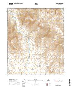
2017 Map of Solomon C-6 NW
USGS Topo · Published 2017About this map
The Eldorado River dominates this portion of the Seward Peninsula, where it winds through a broad, marshy valley characterized by intricate wetland patterns and numerous smaller tributaries. This 2017 survey illustrates the complex drainage systems of the Nome Census Area, where seasonal water flow from the higher elevations reaches the river basin through channels like Florence Cr and Mulligan Cr.
Find a feature on this map
23 named features on this map. Tap any name to fly to it.
Don’t see what you’re looking for? This feature index may not catch every label — zoom into the map to look around manually.
Map Details
Editions of this 2017 Solomon C-6 NW Map
This is the sole edition of this map. No revisions or reprints were ever made.
Other maps of this area

1950 · Nome
USGS Topo · 1:250,000

1950 · Solomon C-6
USGS Topo · 1:63,360

1950 · Solomon
USGS Topo · 1:250,000

1950 · Solomon D-6
USGS Topo · 1:63,360

1950 · Nome D-1
USGS Topo · 1:63,360

1950 · Nome C-1
USGS Topo · 1:63,360

1951 · Nome
USGS Topo · 1:250,000

1951 · Solomon
USGS Topo · 1:250,000

1957 · Nome
USGS Topo · 1:250,000
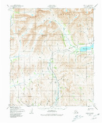
1972 · Nome D-1
USGS Topo · 1:63,360