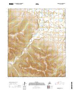
2017 Map of Solomon D-3 NE
USGS Topo · Published 2017About this map
The Fish River dominates this interior landscape of the Seward Peninsula, winding through a complex network of tributaries as it appeared in 2017. The confluence of several major waterways, including the Pargon River and the Rathlatulik River, illustrates the hydrologic importance of this drainage basin. Further downstream, the Etchepuk River meets the main channel, while smaller drainages like San Francisco Cr and Aggie Cr dissect the surrounding uplands. This area within the Nome Census Area is characterized by its dramatic elevation changes, ranging from river basins to high ridgelines south of Cache Cr, mapped here with modern precision. The lack of built infrastructure or roads emphasizes the undisturbed character of this remote Alaskan river system.
Find a feature on this map
13 named features on this map. Tap any name to fly to it.
Don’t see what you’re looking for? This feature index may not catch every label — zoom into the map to look around manually.
Map Details
Editions of this 2017 Solomon D-3 NE Map
This is the sole edition of this map. No revisions or reprints were ever made.
Other maps of this area

1950 · Bendeleben A-3
USGS Topo · 1:63,360

1950 · Bendeleben A-2
USGS Topo · 1:63,360

1950 · Solomon D-2
USGS Topo · 1:63,360

1950 · Bendeleben
USGS Topo · 1:250,000

1950 · Solomon D-3
USGS Topo · 1:63,360

1950 · Solomon
USGS Topo · 1:250,000

1951 · Bendeleben
USGS Topo · 1:250,000

1951 · Solomon
USGS Topo · 1:250,000

1964 · Bendeleben
USGS Topo · 1:250,000
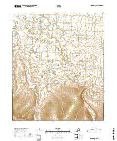
2017 · Solomon D-2 NW
USGS Topo · 1:25,000