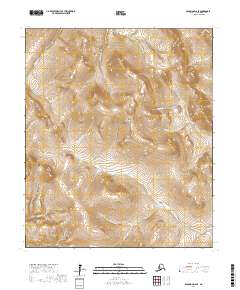
2017 Map of Solomon D-6 SE
USGS Topo · Published 2017About this map
The Casadepaga River carves through this portion of the Seward Peninsula, defining a landscape where drainage patterns tell the story of early 20th-century prospecting. This high-latitude terrain is marked by numerous gold-rush era watercourses, including the evocatively named Ready Bullion Cr, Discovery Cr, and Eldorado Cr. These names are artifacts of the Seward Peninsula's mining history, where every tributary was mapped for its potential yield.
Find a feature on this map
21 named features on this map. Tap any name to fly to it.
Don’t see what you’re looking for? This feature index may not catch every label — zoom into the map to look around manually.
Map Details
Editions of this 2017 Solomon D-6 SE Map
This is the sole edition of this map. No revisions or reprints were ever made.
Other maps of this area

1907 · Casadepaga
USGS Topo · 1:62,500

1907 · Solomon
USGS Topo · 1:62,500

1950 · Solomon C-5
USGS Topo · 1:63,360

1950 · Solomon C-6
USGS Topo · 1:63,360

1950 · Solomon
USGS Topo · 1:250,000

1950 · Solomon D-6
USGS Topo · 1:63,360

1950 · Solomon D-5
USGS Topo · 1:63,360

1951 · Solomon
USGS Topo · 1:250,000
2017 · Solomon D-5 SW
USGS Topo · 1:25,000
2017 · Solomon C-6 NW
USGS Topo · 1:25,000