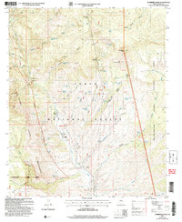
2004 Map of Sombrero Peak
USGS Topo · Published 2007About this map
Sierra Ancha dominates this landscape, where the deeply incised Pueblo Canyon and Devils Chasm drop away from high ridges. This 2004 revision by the Forest Service highlights a territory defined by isolated springs and rugged drainages within the Tonto National Forest, showing a network of 4WD tracks that provide the only modern access to interior landmarks. The presence of Ellison Ranch and Flying H Ranch suggests a long history of cattle ranching in a region where water sources like Bermuda Falls Spring and Yellow Jacket Spring are essential. To the east, the boundary of the Fort Apache Indian Reservation is marked along Bladder Wash, while the Sierra Ancha Wilderness preserves the western reaches. Notable features like Pottery Point and Hog Mountain speak to the specific local nomenclature of this Gila County terrain.
Find a feature on this map
78 named features on this map. Tap any name to fly to it.
Don’t see what you’re looking for? This feature index may not catch every label — zoom into the map to look around manually.
Map Details
Editions of this 2004 Sombrero Peak Map
This is the sole edition of this map. No revisions or reprints were ever made.
Other maps of this area

1922 · Chrysotile
USGS Topo · 1:125,000

1946 · Blue House Mtn
USGS Topo · 1:62,500

1949 · McFadden Peak
USGS Topo · 1:62,500

1949 · Rockinstraw Mtn
USGS Topo · 1:62,500

1950 · Rockinstraw Mtn
USGS Topo · 1:62,500

1950 · McFadden Peak
USGS Topo · 1:62,500

1951 · Blue House Mtn
USGS Topo · 1:62,500

1954 · Mesa
USGS Topo · 1:250,000

1957 · Mesa
USGS Topo · 1:250,000

1958 · Mesa
USGS Topo · 1:250,000