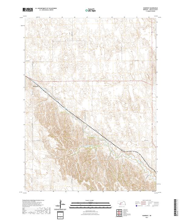
2021 Map of Somerset
USGS Topo · Published 2021About this map
Medicine Cr and Little Medicine Cr cut through the high plains of Lincoln County, carving a network of drainages that define the local geography. The settlement of Somerset sits at the intersection of several rural routes, serving as a focal point for the surrounding agricultural sections. The map reveals a landscape organized by the Public Land Survey System, with roads like S Center Rd and Nelson Rd following section lines across townships T10N and T11N. Named thoroughfares such as Massey-Harris Rd and Wagon Trail Rd suggest the historical importance of specific machinery and transit paths in this farming region. The convergence of these trails toward the creek valleys highlights the relationship between the area's limited water resources and its transportation network.
Find a feature on this map
22 named features on this map. Tap any name to fly to it.
Don’t see what you’re looking for? This feature index may not catch every label — zoom into the map to look around manually.
Map Details
Editions of this 2021 Somerset Map
This is the sole edition of this map. No revisions or reprints were ever made.
Other maps of this area

1954 · McCook
USGS Topo · 1:250,000

1956 · Wellfleet NW
USGS Topo · 1:24,000

1956 · White NE
USGS Topo · 1:24,000

1956 · Curtis NW
USGS Topo · 1:24,000

1956 · Dickens
USGS Topo · 1:24,000

1956 · Somerset
USGS Topo · 1:24,000

1956 · Wellfleet
USGS Topo · 1:24,000

1957 · McCook
USGS Topo · 1:250,000

1958 · McCook
USGS Topo · 1:250,000
1970 · Dickens NE
USGS Topo · 1:24,000