
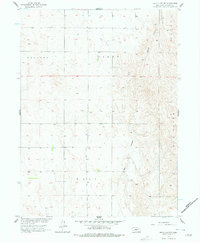
1956 Map of Wellfleet NW
USGS Topo · Published 1957About this map
Moran Canyon cuts through the high plains of Lincoln County in this mid-1950s survey, illustrating the deeply dissected nature of the Nebraska sandhills region. The map captures a landscape defined by sharp drainage patterns and sparse human infrastructure, where the Sellers Plant and various sites marked Well represent the critical intersection of agriculture and water management in a semi-arid environment. This topographic study, conducted as part of the Missouri River Basin development program, provides a technical view of the complex landforms near Box Elder. Researchers can observe how the topography dictates the placement of unimproved dirt roads and light-duty tracks that follow the natural contours of the canyons and tablelands, reflecting the rural ranching economy of the era.
Find a feature on this map
4 named features on this map. Tap any name to fly to it.
Don’t see what you’re looking for? This feature index may not catch every label — zoom into the map to look around manually.
Map Details
Editions of this 1956 Wellfleet NW Map
2 editions found
Other maps of this area

1899 · North Platte
USGS Topo · 1:125,000

1902 · North Platte
USGS Topo · 1:125,000

1954 · McCook
USGS Topo · 1:250,000

1954 · North Platte
USGS Topo · 1:250,000

1956 · North Platte
USGS Topo · 1:250,000

1956 · Somerset
USGS Topo · 1:24,000

1956 · Wellfleet SE
USGS Topo · 1:24,000

1956 · Wellfleet
USGS Topo · 1:24,000

1956 · Wellfleet NE
USGS Topo · 1:24,000

1957 · North Platte
USGS Topo · 1:250,000