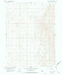
1956 Map of Wellfleet NW
USGS Topo · Published 1978About this map
Moran Canyon and Well Canyon carve deep drainage patterns through the High Plains of Lincoln County in this mid-century survey. The landscape is defined by vast rangelands and localized land divisions such as Sellers Plant and Elder Box. Surveyed as part of the Department of the Interior's effort to develop the Missouri River Basin, the map illustrates the intricate topography of the Nebraska sandhills region before significant modern development. Notable property or survey designations like Well and Payne appear alongside elevation markers, providing a clear record of the area's physical geography and administrative boundaries during the 1950s.
Find a feature on this map
6 named features on this map. Tap any name to fly to it.
Don’t see what you’re looking for? This feature index may not catch every label — zoom into the map to look around manually.
Map Details
Editions of this 1956 Wellfleet NW Map
2 editions found
Other maps of this area

1899 · North Platte
USGS Topo · 1:125,000

1902 · North Platte
USGS Topo · 1:125,000

1954 · McCook
USGS Topo · 1:250,000

1954 · North Platte
USGS Topo · 1:250,000

1956 · North Platte
USGS Topo · 1:250,000

1956 · Wellfleet NW
USGS Topo · 1:24,000

1956 · Somerset
USGS Topo · 1:24,000

1956 · Wellfleet SE
USGS Topo · 1:24,000

1956 · Wellfleet
USGS Topo · 1:24,000

1956 · Wellfleet NE
USGS Topo · 1:24,000