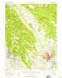
1951 Map of Sonoma
USGS Topo · Published 1958About this map
The Napa River valley floor and surrounding ridges are defined by a mix of early agriculture and institutional development in the years following the war. The Southern Pacific RR and Northwestern Pacific RR provide the backbone for transport between wine-growing communities like Zinfandel and Rutherford. Wineries such as Thomann Winery and estates like Buena Vista are clearly marked, showing the established viticultural footprint of the era. The presence of the State Veterans Home near Yountville and the large footprint of the Napa State Hospital reflect the region's role in public service and state administration.
Find a feature on this map
108 named features on this map. Tap any name to fly to it.
Don’t see what you’re looking for? This feature index may not catch every label — zoom into the map to look around manually.
Map Details
Editions of this 1951 Sonoma Map
3 editions found
Other maps of this area

1896 · Carquinez Strait
USGS Topo · 1:62,500

1898 · Karquines
USGS Topo · 1:62,500

1901 · Karquines
USGS Topo · 1:62,500

1902 · Napa
USGS Topo · 1:125,000

1914 · Petaluma
USGS Topo · 1:62,500

1916 · Mare Island
USGS Topo · 1:62,500

1916 · Santa Rosa
USGS Topo · 1:62,500

1921 · Mt. Vaca
USGS Topo · 1:62,500

1924 · Capay
USGS Topo · 1:62,500

1927 · Calistoga
USGS Topo · 1:62,500