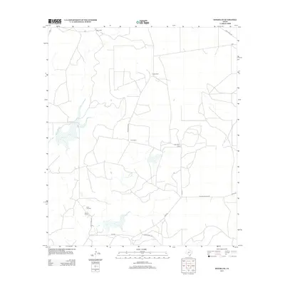
2012 Map of Sonora NE
USGS Topo · Published 2012About this map
The Steen Gas Field and several sprawling family holdings define this portion of the Edwards Plateau in the early 21st century. The landscape is marked by a network of ranching properties, including the Mertz Ranch, Caralita Ranch, and Logan Ranch, which are connected by a sparse grid of rural county roads and private lanes. The presence of the Steen Ranch alongside its namesake gas field illustrates the intersection of traditional West Texas livestock ranching and the region's energy economy. Historically significant routes, such as Old Fort McKavett Rd, cut across the terrain, reflecting the long-standing importance of this corridor for regional travel between distant outposts. Small seasonal drainages and scattered stock ponds provide the only variations in this arid, high-plains environment.
Find a feature on this map
15 named features on this map. Tap any name to fly to it.
Don’t see what you’re looking for? This feature index may not catch every label — zoom into the map to look around manually.
Map Details
Editions of this 2012 Sonora NE Map
This is the sole edition of this map. No revisions or reprints were ever made.
Other maps of this area

1893 · Fort McKavett
USGS Topo · 1:125,000

1954 · Sonora
USGS Topo · 1:250,000

1958 · Sonora
USGS Topo · 1:250,000

1963 · Buffalo Well NW
USGS Topo · 1:24,000

1963 · Buffalo Well SW
USGS Topo · 1:24,000

1963 · Adams SW
USGS Topo · 1:24,000

1964 · Sonora
USGS Topo · 1:24,000

1964 · Sonora SE
USGS Topo · 1:24,000

1964 · Sonora NE
USGS Topo · 1:24,000

1964 · Eldorado SW
USGS Topo · 1:24,000