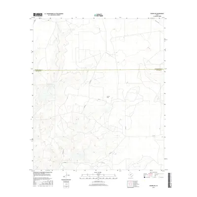
2016 Map of Sonora NE
USGS Topo · Published 2016About this map
Lowrey Draw meanders through this portion of the Edwards Plateau, where the landscape is defined by the high, dry ranching country of West Texas. The boundary between Schleicher Co and Sutton Co bisects the terrain, illustrating the remote and sparse settlement patterns common in the region during the early twenty-first century. Transportation is limited to a network of local thoroughfares such as Co Rd 211 and Ranch Rd 2596, alongside numerous private paths including Pvt Rd 2236 and Pvt Rd 2224. These private access ways suggest the continuing importance of large-scale landholdings and ranching operations. The topography is marked by significant elevation changes, particularly in the western sections where closely packed contours indicate steep slopes and limestone draws characteristic of the Pecos River drainage basin.
Find a feature on this map
10 named features on this map. Tap any name to fly to it.
Don’t see what you’re looking for? This feature index may not catch every label — zoom into the map to look around manually.
Map Details
Editions of this 2016 Sonora NE Map
This is the sole edition of this map. No revisions or reprints were ever made.
Other maps of this area

1893 · Fort McKavett
USGS Topo · 1:125,000

1954 · Sonora
USGS Topo · 1:250,000

1958 · Sonora
USGS Topo · 1:250,000

1963 · Buffalo Well NW
USGS Topo · 1:24,000

1963 · Buffalo Well SW
USGS Topo · 1:24,000

1963 · Adams SW
USGS Topo · 1:24,000

1964 · Sonora
USGS Topo · 1:24,000

1964 · Sonora SE
USGS Topo · 1:24,000

1964 · Sonora NE
USGS Topo · 1:24,000

1964 · Eldorado SW
USGS Topo · 1:24,000