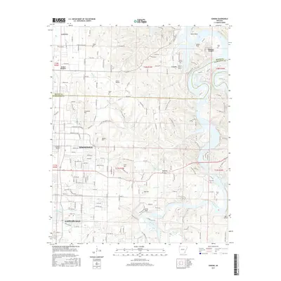
2017 Map of Sonora
USGS Topo · Published 2017About this map
Fayetteville and Springdale dominate the southwestern portion of this landscape, where urban development meets the steep relief of the Ozark transition. The White River carves a deep valley through the eastern half of the map, fed by numerous tributaries such as Friendship Cr and Roberts Cr. The terrain is marked by prominent elevations including Fitzgerald Mtn and Webber Mtn, which overlook the growing corridor between Lowell and the Benton and Washington county line. For local historians, the sheet preserves the location of several small burial grounds like Hickory Creek Cem and Phillips Cem that predate modern suburban expansion. The infrastructure of the region is further defined by aviation hubs, with both the Springdale Municipal Airport and Circle S Farms Airport serving this corner of Northwest Arkansas.
Find a feature on this map
69 named features on this map. Tap any name to fly to it.
Don’t see what you’re looking for? This feature index may not catch every label — zoom into the map to look around manually.
Map Details
Editions of this 2017 Sonora Map
This is the sole edition of this map. No revisions or reprints were ever made.
Other maps of this area

1899 · Fayetteville
USGS Topo · 1:125,000

1900 · Eureka Springs
USGS Topo · 1:125,000

1901 · Eureka Springs
USGS Topo · 1:125,000

1901 · Fayetteville
USGS Topo · 1:125,000

1904 · Fayetteville
USGS Topo · 1:125,000

1945 · Harrison
USGS Topo · 1:250,000

1949 · Harrison
USGS Topo · 1:250,000

1954 · Harrison
USGS Topo · 1:250,000

1954 · Tulsa
USGS Topo · 1:250,000

1957 · War Eagle
USGS Topo · 1:24,000