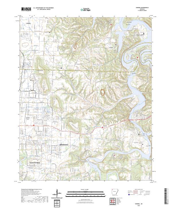
2024 Map of Sonora
USGS Topo · Published 2024About this map
The White River and the expanding waters of Beaver Lake define the eastern edge of this landscape, where the Ozark plateau meets the growing urban corridors of Northwest Arkansas. Settlement patterns here are dense, with the fringes of Springdale, Fayetteville, and Lowell encroaching upon older rural landmarks. Family history is preserved in several small burial grounds, including Phillips Cem, Wilson Cem, and Head Cem, which sit atop the ridges and valleys between the urban centers. The topography is marked by significant rises such as Fitzgerald Mtn and Price Mtn, while the river's legacy is noted at historical crossing points like Neills Bluff Ford and Gibson Ford. Aviation infrastructure is prominent, featuring both the Springdale Municipal Airport and the smaller Circle S Farms Airport, illustrating the region's transition from a collection of rural river bluffs to a vital modern transport hub.
Find a feature on this map
53 named features on this map. Tap any name to fly to it.
Don’t see what you’re looking for? This feature index may not catch every label — zoom into the map to look around manually.
Map Details
Editions of this 2024 Sonora Map
This is the sole edition of this map. No revisions or reprints were ever made.
Other maps of this area

1899 · Fayetteville
USGS Topo · 1:125,000

1900 · Eureka Springs
USGS Topo · 1:125,000

1901 · Eureka Springs
USGS Topo · 1:125,000

1901 · Fayetteville
USGS Topo · 1:125,000

1904 · Fayetteville
USGS Topo · 1:125,000

1945 · Harrison
USGS Topo · 1:250,000

1949 · Harrison
USGS Topo · 1:250,000

1954 · Harrison
USGS Topo · 1:250,000

1954 · Tulsa
USGS Topo · 1:250,000

1957 · War Eagle
USGS Topo · 1:24,000