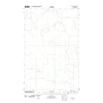
2011 Map of Soo NW
USGS Topo · Published 2011About this map
Redstone Creek and Wolf Creek define the drainage patterns of this rural landscape in Roosevelt County during the early 21st century. The map illustrates a high-plains environment structured by a grid of local access roads including Bergh Rd and Welliver Rd. Unlike more densely populated regions, the infrastructure here is tied primarily to the natural topography of the creek beds, with Wolf Creek Rd following the southern watercourse. This survey captures a specific moment in the land management of the Brockton District, showing how modern transportation routes like Welliver adapt to the undulating terrain of eastern Montana. The map is a record of the sparse but critical network of rural routes that serve the agricultural and ranching interests along the Wolf Crk corridor.
Find a feature on this map
7 named features on this map. Tap any name to fly to it.
Don’t see what you’re looking for? This feature index may not catch every label — zoom into the map to look around manually.
Map Details
Editions of this 2011 Soo NW Map
This is the sole edition of this map. No revisions or reprints were ever made.
Other maps of this area

1954 · Wolf Point
USGS Topo · 1:250,000

1958 · Wolf Point
USGS Topo · 1:250,000

1973 · Navajo
USGS Topo · 1:24,000

1973 · Pleasant Prairie
USGS Topo · 1:24,000

1973 · Pleasant Prairie NE
USGS Topo · 1:24,000

1983 · Redstone
USGS Topo · 1:24,000

1983 · Soo NW
USGS Topo · 1:24,000

1983 · Archer
USGS Topo · 1:24,000
1983 · Thornwood Ranch
USGS Topo · 1:24,000
1983 · Soo NE
USGS Topo · 1:24,000