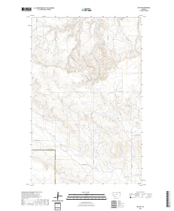
2024 Map of Soo NW
USGS Topo · Published 2024About this map
Wolf Creek and its seasonal tributaries carve a winding path through this corner of the High Plains, where the border between Sheridan Co and Daniels Co marks a straight longitudinal divide in the landscape. The terrain is defined by a sparse network of section roads that follow the township and range lines, reflecting the enduring legacy of the Public Land Survey System in eastern Montana. Travel through this area relies on gravel and dirt routes like Wolf Creek Rd and S Redstone Rd, which connect isolated homesteads and ranching tracts. While largely undeveloped, the map illustrates the persistence of drainage patterns like Redstone Creek, providing a detailed look at the subtle coulees and ridges that dictated early cattle and sheep grazing patterns in this remote region.
Find a feature on this map
14 named features on this map. Tap any name to fly to it.
Don’t see what you’re looking for? This feature index may not catch every label — zoom into the map to look around manually.
Map Details
Editions of this 2024 Soo NW Map
This is the sole edition of this map. No revisions or reprints were ever made.
Other maps of this area

1954 · Wolf Point
USGS Topo · 1:250,000

1958 · Wolf Point
USGS Topo · 1:250,000

1973 · Navajo
USGS Topo · 1:24,000

1973 · Pleasant Prairie
USGS Topo · 1:24,000

1973 · Pleasant Prairie NE
USGS Topo · 1:24,000

1983 · Redstone
USGS Topo · 1:24,000

1983 · Soo NW
USGS Topo · 1:24,000

1983 · Archer
USGS Topo · 1:24,000
1983 · Thornwood Ranch
USGS Topo · 1:24,000
1983 · Soo NE
USGS Topo · 1:24,000