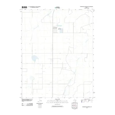
2010 Map of Sourdough Creek NE
USGS Topo · Published 2010About this map
Middle Prong Wolf Creek and South Wolf Creek meander through this portion of the Texas Panhandle, defining a landscape of agricultural utility and intermittent water sources. The area is characterized by a deliberate grid of rural corridors like Co Rd U and Co Rd X, supporting a localized cattle or feed industry indicated by the presence of Perryton Feeders Lake Number 2 and its associated infrastructure. The terrain includes specialized water management features such as the Perryton Feeders Lake Number 2 Dam and Perryton Feeders Lake Number 1 Dam, which serve to capture runoff in this semi-arid region. These small reservoirs and the named tributary Northup Creek underscore the importance of water rights and management for the ranching operations that have long occupied this corner of Ochiltree County.
Find a feature on this map
14 named features on this map. Tap any name to fly to it.
Don’t see what you’re looking for? This feature index may not catch every label — zoom into the map to look around manually.
Map Details
Editions of this 2010 Sourdough Creek NE Map
This is the sole edition of this map. No revisions or reprints were ever made.
Other maps of this area

1954 · Perryton
USGS Topo · 1:250,000

1958 · Perryton
USGS Topo · 1:250,000

1973 · Farnsworth
USGS Topo · 1:24,000

1973 · Booker SW
USGS Topo · 1:24,000

1973 · Sourdough Creek NE
USGS Topo · 1:24,000

1973 · Pickett Ranch Creek
USGS Topo · 1:24,000

1973 · Perryton SE
USGS Topo · 1:24,000

1973 · Lake Fryer
USGS Topo · 1:24,000

1973 · Sourdough Creek SW
USGS Topo · 1:24,000

1973 · Sourdough Creek NW
USGS Topo · 1:24,000