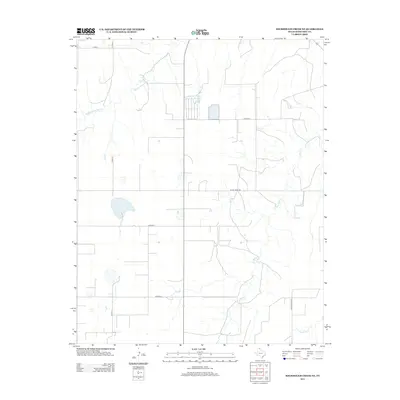
2012 Map of Sourdough Creek NE
USGS Topo · Published 2012About this map
Perryton Feeders Lake Number 2 stands as a central water feature in this portion of the Texas Panhandle, anchoring a landscape defined by ranching and rural transport networks. This 2012 survey reveals the intricate drainage patterns of Middle Prong Wolf Cr and S Wolf Cr, which cut through the high plains of Ochiltree County. The map documents the persistent grid of county roads, such as Co Road U and Co Road X, that provide access to the expansive agricultural tracts in this region. Private and state infrastructure is evident through markers like Leslie Ranch Rd and Ranch Road 759, reflecting the modern-era management of large-scale land holdings and water resources near Northup Cr.
Find a feature on this map
11 named features on this map. Tap any name to fly to it.
Don’t see what you’re looking for? This feature index may not catch every label — zoom into the map to look around manually.
Map Details
Editions of this 2012 Sourdough Creek NE Map
This is the sole edition of this map. No revisions or reprints were ever made.
Other maps of this area

1954 · Perryton
USGS Topo · 1:250,000

1958 · Perryton
USGS Topo · 1:250,000

1973 · Farnsworth
USGS Topo · 1:24,000

1973 · Booker SW
USGS Topo · 1:24,000

1973 · Sourdough Creek NE
USGS Topo · 1:24,000

1973 · Pickett Ranch Creek
USGS Topo · 1:24,000

1973 · Perryton SE
USGS Topo · 1:24,000

1973 · Lake Fryer
USGS Topo · 1:24,000

1973 · Sourdough Creek SW
USGS Topo · 1:24,000

1973 · Sourdough Creek NW
USGS Topo · 1:24,000