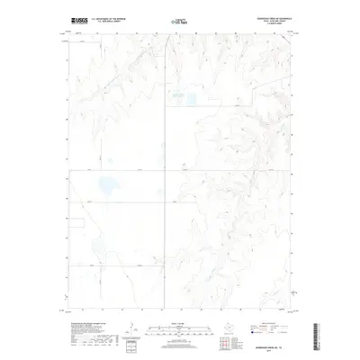
2019 Map of Sourdough Creek NE
USGS Topo · Published 2019About this map
Middle Prong Wolf Creek and South Wolf Creek carve deep, branching drainages through this portion of the Texas Panhandle, creating a landscape defined by sharp elevation shifts in an otherwise level prairie. The presence of Perryton Feeders Lake Number 2 and various smaller basins suggests a focus on water management for ranching and agricultural operations in Ochiltree County. The land is organized by a strict rectilinear grid of county roads, including County Road 13 and County Road S, which intersect the primary east-west thoroughfare of FM 759. In the southeastern corner, Northup Creek marks another drainage point, illustrating how the natural erosion of the creek beds has shaped the regional transport and property boundaries across this high plains terrain.
Find a feature on this map
11 named features on this map. Tap any name to fly to it.
Don’t see what you’re looking for? This feature index may not catch every label — zoom into the map to look around manually.
Map Details
Editions of this 2019 Sourdough Creek NE Map
This is the sole edition of this map. No revisions or reprints were ever made.
Other maps of this area

1954 · Perryton
USGS Topo · 1:250,000

1958 · Perryton
USGS Topo · 1:250,000

1973 · Farnsworth
USGS Topo · 1:24,000

1973 · Booker SW
USGS Topo · 1:24,000

1973 · Sourdough Creek NE
USGS Topo · 1:24,000

1973 · Pickett Ranch Creek
USGS Topo · 1:24,000

1973 · Perryton SE
USGS Topo · 1:24,000

1973 · Lake Fryer
USGS Topo · 1:24,000

1973 · Sourdough Creek SW
USGS Topo · 1:24,000

1973 · Sourdough Creek NW
USGS Topo · 1:24,000