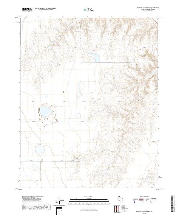
2022 Map of Sourdough Creek NE
USGS Topo · Published 2022About this map
Middle Prong Wolf Creek and South Wolf Creek carve intricate drainage patterns across this High Plains landscape in Ochiltree County. The terrain is defined by a network of ranch and county roads, including County Road 13 and Farm to Market Road 759, which intersect the vast agricultural and grazing lands. A significant artificial water feature, Perryton Feeders Lake Number 2, sits in the northern portion of the quadrangle, serving the local cattle industry. The geography is characterized by the transition from flat tabletop lands to the eroding breaks of the Wolf Creek system, with Northup Creek appearing in the southeastern corner. This modern survey by the U.S. Geological Survey captures the specialized land use and infrastructure necessary for contemporary Texas Panhandle ranching operations.
Find a feature on this map
11 named features on this map. Tap any name to fly to it.
Don’t see what you’re looking for? This feature index may not catch every label — zoom into the map to look around manually.
Map Details
Editions of this 2022 Sourdough Creek NE Map
This is the sole edition of this map. No revisions or reprints were ever made.
Other maps of this area

1954 · Perryton
USGS Topo · 1:250,000

1958 · Perryton
USGS Topo · 1:250,000

1973 · Farnsworth
USGS Topo · 1:24,000

1973 · Booker SW
USGS Topo · 1:24,000

1973 · Sourdough Creek NE
USGS Topo · 1:24,000

1973 · Pickett Ranch Creek
USGS Topo · 1:24,000

1973 · Perryton SE
USGS Topo · 1:24,000

1973 · Lake Fryer
USGS Topo · 1:24,000

1973 · Sourdough Creek SW
USGS Topo · 1:24,000

1973 · Sourdough Creek NW
USGS Topo · 1:24,000