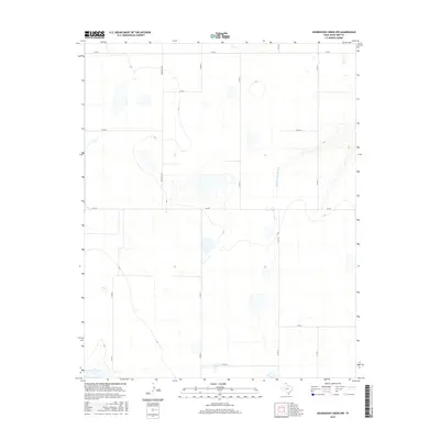
2016 Map of Sourdough Creek NW
USGS Topo · Published 2016About this map
The Middle Prong Wolf Cr defines the drainage of this Ochiltree County landscape, where the High Plains terrain is etched by gradual depressions and seasonal watercourses. This territory is primarily structured by a precise grid of rural transit lines, including Ranch Rd 376 and FM 759, which serve the expansive agricultural and ranching operations characteristic of the Texas Panhandle. The map reveals the modern infrastructure of the region through its network of county roads such as Co Rd S and Co Rd U. These routes follow section lines, illustrating how late 20th-century land management and energy interests have maintained the historical survey patterns of North Texas. While the landscape appears sparsely populated, the systematic placement of roads like Co Rd AA and Co Rd 6 indicates a highly organized approach to accessing this productive interior.
Find a feature on this map
13 named features on this map. Tap any name to fly to it.
Don’t see what you’re looking for? This feature index may not catch every label — zoom into the map to look around manually.
Map Details
Editions of this 2016 Sourdough Creek NW Map
This is the sole edition of this map. No revisions or reprints were ever made.
Other maps of this area

1954 · Perryton
USGS Topo · 1:250,000

1958 · Perryton
USGS Topo · 1:250,000

1973 · Farnsworth
USGS Topo · 1:24,000

1973 · Sourdough Creek NE
USGS Topo · 1:24,000

1973 · Perryton SE
USGS Topo · 1:24,000

1973 · Waka
USGS Topo · 1:24,000

1973 · Sourdough Creek SW
USGS Topo · 1:24,000

1973 · Spearman NE
USGS Topo · 1:24,000

1973 · Sourdough Creek NW
USGS Topo · 1:24,000

1973 · Spearman SE
USGS Topo · 1:24,000