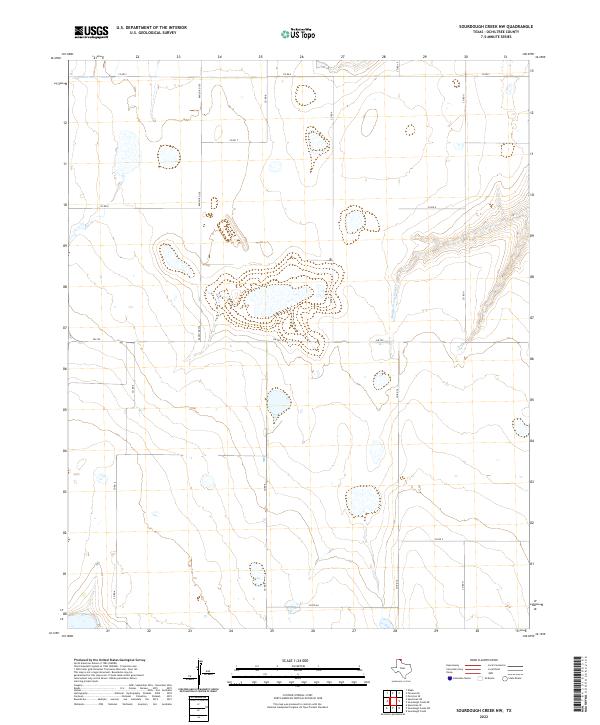
2022 Map of Sourdough Creek NW
USGS Topo · Published 2022About this map
The Middle Prong Wolf Cr drainage defines the eastern portion of this high plains landscape in Ochiltree County, where the terrain transitions from flat agricultural plateaus into the etched draws of the Panhandle. A network of county roads, including Co Rd S and Co Rd 10, follows the section lines of the rectangular survey system, reflecting a region organized around large-scale ranching and dryland farming. Major transit corridors like Fm 759 and Ranch Rd 376 provide the primary connections across this sparse area, intersecting at the center of the sheet. The map reveals the characteristic playa lake depressions common to the Llano Estacado, which serve as vital natural water catchments in an otherwise semi-arid environment. These subtle topographic features, alongside the meandering path of the creek, illustrate the delicate balance of water and land management in modern Texas ranch country.
Find a feature on this map
13 named features on this map. Tap any name to fly to it.
Don’t see what you’re looking for? This feature index may not catch every label — zoom into the map to look around manually.
Map Details
Editions of this 2022 Sourdough Creek NW Map
This is the sole edition of this map. No revisions or reprints were ever made.
Other maps of this area

1954 · Perryton
USGS Topo · 1:250,000

1958 · Perryton
USGS Topo · 1:250,000

1973 · Farnsworth
USGS Topo · 1:24,000

1973 · Sourdough Creek NE
USGS Topo · 1:24,000

1973 · Perryton SE
USGS Topo · 1:24,000

1973 · Waka
USGS Topo · 1:24,000

1973 · Sourdough Creek SW
USGS Topo · 1:24,000

1973 · Spearman NE
USGS Topo · 1:24,000

1973 · Sourdough Creek NW
USGS Topo · 1:24,000

1973 · Spearman SE
USGS Topo · 1:24,000