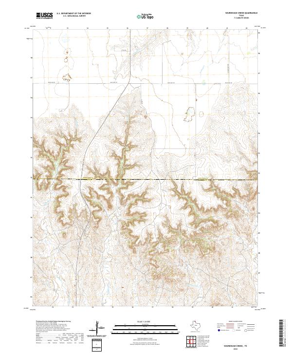
2022 Map of Sourdough Creek
USGS Topo · Published 2022About this map
Ochiltree County and Roberts County are divided by a clear boundary line that cuts across a landscape dominated by the intricate drainage systems of the Texas Panhandle. The central feature, Sourdough Creek, winds through complex canyon-like terrain, joined by tributaries such as Dugout Creek and Picketts Ranch Creek. This area remains largely defined by large-scale ranching and rural infrastructure, evidenced by the presence of Leslie Ranch Road and Ranch Road 281. The map reveals a transition from the flatter northern tablelands, where S Wolf Creek and Northup Creek originate, into the more eroded, broken country to the south. This transition highlights the significant elevation changes and natural erosion patterns that have shaped the land use and road placements in this part of Texas.
Find a feature on this map
12 named features on this map. Tap any name to fly to it.
Don’t see what you’re looking for? This feature index may not catch every label — zoom into the map to look around manually.
Map Details
Editions of this 2022 Sourdough Creek Map
This is the sole edition of this map. No revisions or reprints were ever made.
Other maps of this area

1954 · Perryton
USGS Topo · 1:250,000

1954 · Amarillo
USGS Topo · 1:250,000

1958 · Perryton
USGS Topo · 1:250,000

1958 · Amarillo
USGS Topo · 1:250,000

1971 · Dry Creek NE
USGS Topo · 1:24,000

1971 · Dry Creek North
USGS Topo · 1:24,000

1972 · Horse Creek North
USGS Topo · 1:24,000

1973 · Sourdough Creek NE
USGS Topo · 1:24,000

1973 · Pickett Ranch Creek
USGS Topo · 1:24,000

1973 · Lake Fryer
USGS Topo · 1:24,000