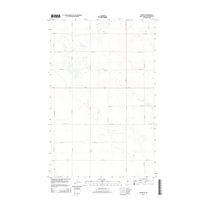
2014 Map of Souris SE
USGS Topo · Published 2014About this map
Stone Cr meanders across this rural Bottineau County landscape, defining the hydrology of a region dominated by a precise section-line grid of roads. The intersection of ND-14 and ND-5 serves as a primary transit point for this agricultural corridor, while local routes like White Spur Rd and a series of numbered avenues and streets—ranging from 4th Ave NE to 9th Ave NE—provide access to individual farmsteads and fields. This map captures the highly organized spatial arrangement of the North Dakota prairie, where the natural course of the creek is the primary break in the geometric regularity of the land. It is a study of how modern infrastructure and water management intersect in a productive plains environment during the early 21st century.
Find a feature on this map
17 named features on this map. Tap any name to fly to it.
Don’t see what you’re looking for? This feature index may not catch every label — zoom into the map to look around manually.
Map Details
Editions of this 2014 Souris SE Map
This is the sole edition of this map. No revisions or reprints were ever made.
Other maps of this area

1949 · Kramer
USGS Topo · 1:24,000

1950 · Kramer
USGS Topo · 1:24,000

1954 · Souris SW
USGS Topo · 1:24,000

1954 · Souris
USGS Topo · 1:24,000

1954 · Souris SE
USGS Topo · 1:24,000

1954 · Gardena
USGS Topo · 1:24,000

1954 · Minot
USGS Topo · 1:250,000
1955 · Upham NE
USGS Topo · 1:24,000

1955 · Bottineau
USGS Topo · 1:24,000

1956 · Carbury
USGS Topo · 1:24,000