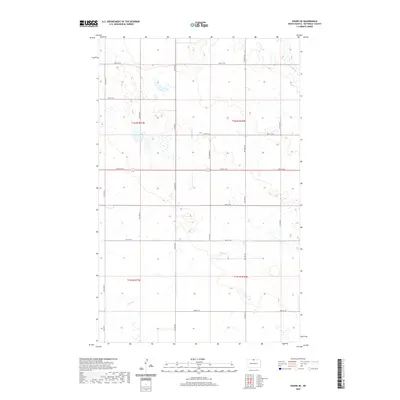
2020 Map of Souris SE
USGS Topo · Published 2020About this map
Stone Cr winds through this expanse of the North Dakota plains, defining the drainage patterns of a landscape marked by numerous prairie potholes and seasonal wetlands. The terrain is organized by the Public Land Survey System, with the boundaries of T162n R76w, T162n R77w, T161n R76w, and T161n R77w meeting here. A precise grid of section-line roads, including 100th St NE and 93rd St NE, partitions the land into the traditional agricultural blocks of Bottineau County. This 2020 survey illustrates a sparsely populated region where the natural hydrology of the Great Plains remains a dominant feature, as small basins of water are interspersed among the cultivated fields and rural homesteads of the northern borderlands.
Find a feature on this map
12 named features on this map. Tap any name to fly to it.
Don’t see what you’re looking for? This feature index may not catch every label — zoom into the map to look around manually.
Map Details
Editions of this 2020 Souris SE Map
This is the sole edition of this map. No revisions or reprints were ever made.
Other maps of this area

1949 · Kramer
USGS Topo · 1:24,000

1950 · Kramer
USGS Topo · 1:24,000

1954 · Souris SW
USGS Topo · 1:24,000

1954 · Souris
USGS Topo · 1:24,000

1954 · Souris SE
USGS Topo · 1:24,000

1954 · Gardena
USGS Topo · 1:24,000

1954 · Minot
USGS Topo · 1:250,000
1955 · Upham NE
USGS Topo · 1:24,000

1955 · Bottineau
USGS Topo · 1:24,000

1956 · Carbury
USGS Topo · 1:24,000