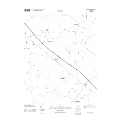
2013 Map of South Anna
USGS Topo · Published 2013About this map
Gum Spring and the surrounding rural communities of central Virginia are documented here in detail, showing a landscape defined by small settlements and an intricate network of creeks. The South Anna River flows across the northern reaches, while the terrain to the south is drained by several watercourses including Big Lickinghole Cr and Rocketts Cr. Interstate 64 cuts diagonally through the center of the sheet, providing a modern transit corridor that connects historic locations like Hadensville and Sandy Hook. Residential enclaves such as Deep Woods, Orchid, and Deerwood suggest a pattern of modern growth within a traditionally agricultural and forested area. Several small impoundments, including Lake Killarney and Orchid Lake, dot the landscape, highlighting the local management of water resources in this part of the Piedmont. Historical road traces like Three Chopt Rd remain visible, anchoring the modern map to its colonial-era transportation roots.
Find a feature on this map
85 named features on this map. Tap any name to fly to it.
Don’t see what you’re looking for? This feature index may not catch every label — zoom into the map to look around manually.
Map Details
Editions of this 2013 South Anna Map
This is the sole edition of this map. No revisions or reprints were ever made.
Other maps of this area

1890 · Goochland
USGS Topo · 1:125,000

1891 · Palmyra
USGS Topo · 1:125,000

1892 · Goochland
USGS Topo · 1:125,000

1895 · Palmyra
USGS Topo · 1:125,000

1897 · Palmyra
USGS Topo · 1:125,000

1942 · Pendleton
USGS Topo · 1:24,000

1942 · Buckner
USGS Topo · 1:24,000

1943 · Goochland
USGS Topo · 1:31,680

1943 · Perkinsville
USGS Topo · 1:31,680

1943 · Pendleton
USGS Topo · 1:31,680