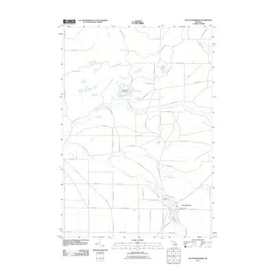
2011 Map of South Boardman
USGS Topo · Published 2011About this map
The South Boardman settlement serves as the primary hub of this landscape, situated near the convergence of major local routes and the South Branch Boardman River. This 2011 survey illustrates a region defined by its hydrography, where the northern section is densely clustered with glacial features like the Sand Lakes, Darby Lake, and Island Lake. Local history and genealogy are centered on the South Boardman Cemetery and the village's Post Office, which anchor the community identity.
Find a feature on this map
62 named features on this map. Tap any name to fly to it.
Don’t see what you’re looking for? This feature index may not catch every label — zoom into the map to look around manually.
Map Details
Editions of this 2011 South Boardman Map
This is the sole edition of this map. No revisions or reprints were ever made.
Other maps of this area

1954 · Traverse City
USGS Topo · 1:250,000

1956 · Mancelona
USGS Topo · 1:62,500

1956 · Kalkaska
USGS Topo · 1:62,500

1956 · Fife Lake
USGS Topo · 1:62,500

1957 · Elk Rapids
USGS Topo · 1:62,500

1958 · Traverse City
USGS Topo · 1:250,000

1983 · Traverse City
USGS Topo · 1:100,000
1983 · Torch River
USGS Topo · 1:24,000
1983 · Williamsburg
USGS Topo · 1:25,000
1985 · Kalkaska
USGS Topo · 1:24,000
Featured Places
- Whitewater Township, MI
- Union Township, MI
- Boardman Township, MI
- South Boardman, MI
- Kalkaska Township, MI