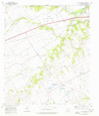
1965 Map of South Bosque
USGS Topo · Published 1977About this map
The Middle Bosque River and South Bosque River converge in this central Texas landscape, where the growing suburbs of Woodway meet rural McLennan County during the mid-1960s. The terrain is defined by the winding drainages of Harris Creek, Willow Creek, and North Cow Bayou, interspersed with gravel pits and quarries that point to the area's geological utility. The St Louis Southwestern railroad cuts a straight line across the north, passing just south of the McGregor Municipal Airfield. Significant for genealogists are localized landmarks like the Horne Cem and the Harris Creek Ch, alongside small settlements such as Spring Valley and Val Verde Camp. Water management is a visible priority, with several mapped spillways and the southern reaches of Lake Waco appearing in the northeast corner.
Find a feature on this map
27 named features on this map. Tap any name to fly to it.
Don’t see what you’re looking for? This feature index may not catch every label — zoom into the map to look around manually.
Map Details
Editions of this 1965 South Bosque Map
3 editions found
Other maps of this area

1892 · Temple
USGS Topo · 1:125,000

1892 · Waco
USGS Topo · 1:125,000

1920 · Waco
USGS Topo · 1:125,000

1924 · Waco 4-c
USGS Topo · 1:48,000

1924 · Waco 3-d
USGS Topo · 1:48,000

1924 · Temple 2-C
USGS Topo · 1:48,000

1931 · Valley Mills
USGS Topo · 1:62,500

1931 · Elm Mott
USGS Topo · 1:62,500

1931 · Mc Gregor
USGS Topo · 1:62,500

1954 · Waco
USGS Topo · 1:250,000