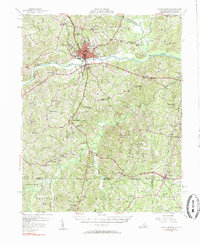
1957 Map of South Boston
USGS Topo · Published 1984About this map
South Boston serves as the regional hub for this mid-century survey, situated at a strategic bend of the Dan River where several major rail lines converge. The Southern railroad, Atlantic and Danville, and Norfolk and Western lines intersect here, illustrating the town's importance as a transportation and trade center for southern Virginia. The surrounding landscape of Halifax Co is densely dotted with rural landmarks that reflect a deeply rooted agrarian community, including the Berry Hill estate and a high concentration of country churches like Sinai Ch and Dan River Bethel Ch. Crossing south into North Carolina, the map covers parts of Person Co and Granville Co, highlighting more remote settlements like Bethel Hill. This document records the rural infrastructure of the 1950s, from the Gaging Sta on the river to small community centers like Cluster Springs.
Find a feature on this map
84 named features on this map. Tap any name to fly to it.
Don’t see what you’re looking for? This feature index may not catch every label — zoom into the map to look around manually.
Map Details
Editions of this 1957 South Boston Map
3 editions found

Other maps of this area

1941 · Clarksville
USGS Topo · 1:48,000

1943 · Clarksville
USGS Topo · 1:62,500

1943 · Roxboro
USGS Topo · 1:62,500

1952 · Milton
USGS Topo · 1:62,500

1953 · Oxford
USGS Topo · 1:62,500

1953 · South Boston
USGS Topo · 1:62,500

1953 · Greensboro
USGS Topo · 1:250,000

1954 · Greensboro
USGS Topo · 1:250,000

1954 · Clover
USGS Topo · 1:62,500

1954 · Halifax
USGS Topo · 1:62,500