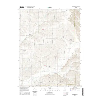
2016 Map of South Boston
USGS Topo · Published 2016About this map
The Middle Fork Blue River and South Fork Blue River define the undulating landscape of southeastern Indiana as it appeared in the mid-2010s. The settlement of South Boston sits as a primary junction for local routes like S Boston Pekin Rd and E Canton S Boston RD. This map documents a series of rural communities and elevated terrain features, including Bowers Knob, Williams Knob, and the settlement of Daisy Hill near the southern border. For genealogists and local historians, the sheet preserves the location of several burial grounds, such as Chestnut Hill Cem and Mount Pleasant Cem, alongside small population centers like New Salem and Bunker Hill. The proximity of the Washington Co Scott Co and Washington Co Clark Co lines illustrates how these county boundaries intersect with the natural drainage patterns of creeks like Whiskey Run and Springle Cr.
Find a feature on this map
95 named features on this map. Tap any name to fly to it.
Don’t see what you’re looking for? This feature index may not catch every label — zoom into the map to look around manually.
Map Details
Editions of this 2016 South Boston Map
This is the sole edition of this map. No revisions or reprints were ever made.
Other maps of this area

1938 · Speed
USGS Topo · 1:24,000

1941 · Borden
USGS Topo · 1:24,000

1947 · Speed
USGS Topo · 1:24,000

1947 · Scottsburg
USGS Topo · 1:24,000

1949 · Henryville
USGS Topo · 1:24,000

1950 · Salem
USGS Topo · 1:24,000

1950 · Palmyra
USGS Topo · 1:24,000

1953 · Kossuth
USGS Topo · 1:24,000

1955 · South Boston
USGS Topo · 1:24,000

1956 · Vincennes
USGS Topo · 1:250,000