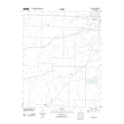
2012 Map of South Fork
USGS Topo · Published 2012About this map
West Plains serves as the primary urban anchor at the northeastern edge of this Howell County landscape, where the Ozark terrain transitions into a complex network of waterways. The drainage pattern is dominated by the South Fork Spring River and Spring Creek, which are fed by numerous tributaries including Forrest Branch, Mustion Creek, and Davis Creek. This 2012 survey illustrates the rural character of the region, punctuated by smaller settlements like Homeland and South Fork along the highway corridor. Local genealogy and community history are preserved at sites such as Pleasant Hill Cemetery and Blue Mound Cemetery, while the presence of the Arrowhead Lakes and the MDC 8960 landmark indicates contemporary land management and recreational use within this river-fed valley.
Find a feature on this map
68 named features on this map. Tap any name to fly to it.
Don’t see what you’re looking for? This feature index may not catch every label — zoom into the map to look around manually.
Map Details
Editions of this 2012 South Fork Map
This is the sole edition of this map. No revisions or reprints were ever made.
Other maps of this area

1938 · West Plains
USGS Topo · 1:24,000

1939 · Topaz
USGS Topo · 1:62,500

1940 · West Plains
USGS Topo · 1:24,000

1941 · Topaz
USGS Topo · 1:62,500

1944 · West Plains
USGS Topo · 1:62,500

1944 · Cureall
USGS Topo · 1:62,500

1945 · Harrison
USGS Topo · 1:250,000

1945 · Willow Springs
USGS Topo · 1:62,500

1946 · West Plains
USGS Topo · 1:62,500

1946 · Cureall
USGS Topo · 1:62,500