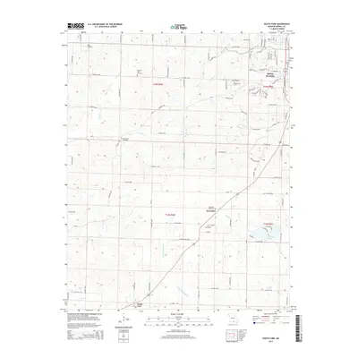
2015 Map of South Fork
USGS Topo · Published 2015About this map
West Plains serves as the urban anchor at the northeastern corner of this Howell County landscape, where residential developments like Deer Valley and Chateau Drive meet the rural Ozark plateau. The terrain is defined by a dense network of seasonal drainages and creek forks, including S Fork Howell Cr and Mustion Cr, which carve through the undulating topography. For genealogists, the map preserves several significant burial sites, such as the Spears Graveyard and Pleasant Hill Cemetery, situated near early crossroads settlements. The transition from the established streets of the city to the small communities of Homeland and South Fork illustrates the southern expansion of the county seat. Moving south, the map documents the headwaters of the S Fork Spring River, a critical hydrological feature of the region.
Find a feature on this map
98 named features on this map. Tap any name to fly to it.
Don’t see what you’re looking for? This feature index may not catch every label — zoom into the map to look around manually.
Map Details
Editions of this 2015 South Fork Map
This is the sole edition of this map. No revisions or reprints were ever made.
Other maps of this area

1938 · West Plains
USGS Topo · 1:24,000

1939 · Topaz
USGS Topo · 1:62,500

1940 · West Plains
USGS Topo · 1:24,000

1941 · Topaz
USGS Topo · 1:62,500

1944 · West Plains
USGS Topo · 1:62,500

1944 · Cureall
USGS Topo · 1:62,500

1945 · Harrison
USGS Topo · 1:250,000

1945 · Willow Springs
USGS Topo · 1:62,500

1946 · West Plains
USGS Topo · 1:62,500

1946 · Cureall
USGS Topo · 1:62,500