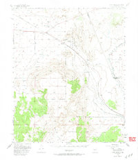
1956 Map of South Garcia
USGS Topo · Published 1974About this map
The Laguna Indian Reservation and Antonio Sedillo Grant define the complex land tenure of this high-desert landscape west of Albuquerque. The mid-century transport corridor is clearly delineated by the Atchison Topeka and Santa Fe railroad line, which follows the path of the Rio San Jose through the northern reaches of the quadrangle. Settlements like Suwanee and the Antonio Sedillo Grant Hdqrs provide anchor points for local history, while the southern terrain is dominated by the massive rise of Mesa Lucero.
Find a feature on this map
34 named features on this map. Tap any name to fly to it.
Don’t see what you’re looking for? This feature index may not catch every label — zoom into the map to look around manually.
Map Details
Editions of this 1956 South Garcia Map

Other maps of this area

1883 · Mt. Taylor
USGS Topo · 1:250,000

1886 · Mt. Taylor
USGS Topo · 1:250,000

1888 · Bernalillo
USGS Topo · 1:125,000

1889 · Albuquerque
USGS Topo · 1:125,000

1892 · Mt. Taylor
USGS Topo · 1:250,000

1893 · Albuquerque
USGS Topo · 1:125,000

1899 · Mt. Taylor
USGS Topo · 1:250,000

1917 · Cerro Verde
USGS Topo · 1:125,000

1952 · Belen NW
USGS Topo · 1:24,000

1952 · Rio Puerco
USGS Topo · 1:24,000