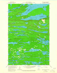
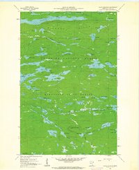
1960 Map of South Lake
USGS Topo · Published 1965About this map
The United States Canada border cuts through a dense landscape of interconnected waterways and portage routes in this 1960 survey of Cook County. The Height of Land Portage serves as a critical geographic marker between South Lake and North Lake, while the legacy of early infrastructure is visible in the Railroad Grade and Railroad Portage near Little North Lake. This region, split between the Superior National Forest and the Minnesota State Forest, highlights the transition from industrial extraction to managed wilderness. Settlement is sparse, with recreation represented by the Iron Lake Campground and travel facilitated by the Gunflint Trail. The map meticulously details depth curves for major bodies like Gunflint Lake and Mayhew Lake, providing a comprehensive view of the hydrography that defined the area's timber and transit history.
Find a feature on this map
65 named features on this map. Tap any name to fly to it.
Don’t see what you’re looking for? This feature index may not catch every label — zoom into the map to look around manually.
Map Details
Editions of this 1960 South Lake Map
4 editions found
Other maps of this area

1919 · Brule Lake
USGS Topo · 1:62,500

1954 · Two Harbors
USGS Topo · 1:250,000

1957 · Two Harbors
USGS Topo · 1:250,000

1957 · Quetico
USGS Topo · 1:250,000

1958 · Two Harbors
USGS Topo · 1:250,000

1959 · Lima Mountain
USGS Topo · 1:24,000

1959 · Hungry Jack Lake
USGS Topo · 1:24,000
1960 · South Lake
USGS Topo · 1:24,000
1960 · Eagle Mountain
USGS Topo · 1:24,000

1960 · Brule Lake
USGS Topo · 1:24,000