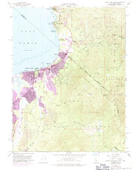
1955 Map of South Lake Tahoe
USGS Topo · Published 1971About this map
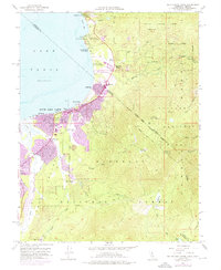
South Lake Tahoe and the neighboring settlements of Bijou and Al Tahoe reflect the mid-century transition of the southern shore from a seasonal retreat to a permanent community. Surveyed originally in 1955 with significant 1969 updates shown in purple, this map documents the rapid expansion of urban areas around Stateline and Tahoe Valley. The landscape is a mix of recreational development and established infrastructure, featuring the Heavenly Valley Ski Lodge and the 4H Club Camp alongside essential services like Barton Memorial Hospital. Genealogy and local history researchers will find the location of the Happy Homestead Cemetery and the historical Sierra House site significant. The rugged terrain of the Toiyabe National Forest and Eldorado National Forest looms over the valley, where Trout Creek and the Truckee River flow toward the lake's edge.
Find a feature on this map
50 named features on this map. Tap any name to fly to it.
Don’t see what you’re looking for? This feature index may not catch every label — zoom into the map to look around manually.
Map Details
Editions of this 1955 South Lake Tahoe Map
7 editions found

Other maps of this area

1889 · Pyramid Peak
USGS Topo · 1:125,000

1889 · Markleeville
USGS Topo · 1:125,000

1891 · Carson
USGS Topo · 1:125,000

1891 · Markleeville
USGS Topo · 1:125,000

1891 · Truckee
USGS Topo · 1:125,000

1891 · Pyramid Peak
USGS Topo · 1:125,000

1893 · Carson
USGS Topo · 1:125,000

1893 · Markleeville
USGS Topo · 1:125,000

1893 · Truckee
USGS Topo · 1:125,000

1895 · Pyramid Peak
USGS Topo · 1:125,000