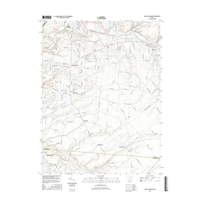
2016 Map of South Lebanon
USGS Topo · Published 2016About this map
The Little Miami River winds through this landscape, carving a valley that separates the northern settlements of South Lebanon and Morrow from the southern upland communities. This modern survey illustrates a network of small towns and historic centers such as Maineville, Murdock, and Dallasburg, each surrounded by family-named landmarks and cemeteries like Woodville Cem and Murdock Cem. The map highlights the preservation of historical routes and natural spaces, notably where the N Country National Scenic Trail (Buckeye Trail) follows the river corridor. For genealogists and local historians, the high density of small burial grounds, including the Juterboch Farm Cem and Barrett Cem, provides a detailed record of local family lineages. Residential growth is visible in the newer subdivisions around Hopkinsville, yet the traditional rural character of the area is maintained through vast tracts of open land and water features like Oeder Lake and Sunrise Lake.
Find a feature on this map
184 named features on this map. Tap any name to fly to it.
Don’t see what you’re looking for? This feature index may not catch every label — zoom into the map to look around manually.
Map Details
Editions of this 2016 South Lebanon Map
This is the sole edition of this map. No revisions or reprints were ever made.
Other maps of this area

1898 · East Cincinnati
USGS Topo · 1:62,500

1904 · Mason
USGS Topo · 1:62,500

1906 · Mason
USGS Topo · 1:62,500

1914 · East Cincinnati
USGS Topo · 1:62,500

1914 · Batavia
USGS Topo · 1:48,000

1914 · Morrow
USGS Topo · 1:62,500

1916 · Batavia
USGS Topo · 1:62,500

1916 · Morrow
USGS Topo · 1:62,500

1953 · Goshen
USGS Topo · 1:24,000

1953 · Newtonsville
USGS Topo · 1:24,000