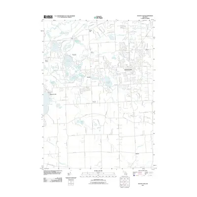
2011 Map of South Lyon
USGS Topo · Published 2011About this map
The city of South Lyon stands as a central hub on this 2011 survey, showing a landscape defined by an extensive network of glacial lakes and historical burial grounds. The area transitions from the more densely settled grid of the city to the lakeside communities and wetlands of the Huron River valley. This sheet is particularly rich in genealogical landmarks, recording numerous family and local resting places such as the Old Irish Cemetery, Hayes Cemetery, and Green Oak Cemetery.
Find a feature on this map
63 named features on this map. Tap any name to fly to it.
Don’t see what you’re looking for? This feature index may not catch every label — zoom into the map to look around manually.
Map Details
Editions of this 2011 South Lyon Map
This is the sole edition of this map. No revisions or reprints were ever made.
Other maps of this area

1902 · South Lyon
USGS Topo · 1:62,500

1902 · Dexter
USGS Topo · 1:62,500

1904 · Ann Arbor
USGS Topo · 1:125,000

1906 · Dexter
USGS Topo · 1:62,500

1906 · South Lyon
USGS Topo · 1:62,500

1907 · Howell
USGS Topo · 1:62,500

1908 · Ann Arbor
USGS Topo · 1:125,000

1909 · Howell
USGS Topo · 1:62,500

1909 · Milford
USGS Topo · 1:62,500

1936 · Wixom
USGS Topo · 1:31,680
Featured Places
- Lyon Charter Township, MI
- Green Oak Charter Township, MI
- South Lyon, MI
- Northfield Township, MI
- Whitmore Lake, Green Oak Charter Township