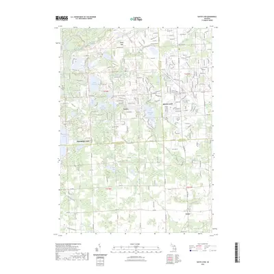
2023 Map of South Lyon
USGS Topo · Published 2023About this map
The Huron River and Spring Mill Creek flow through this landscape where Livingston, Oakland, and Washtenaw counties converge. The town of South Lyon serves as a central hub, surrounded by a dense network of residential streets and local landmarks such as Lyon Lake and Inchwagh Lake. Further south, the map details the small community of Worden and the northern shores of Whitmore Lake, including Lawton Lake.
Find a feature on this map
211 named features on this map. Tap any name to fly to it.
Don’t see what you’re looking for? This feature index may not catch every label — zoom into the map to look around manually.
Map Details
Editions of this 2023 South Lyon Map
This is the sole edition of this map. No revisions or reprints were ever made.
Other maps of this area

1902 · South Lyon
USGS Topo · 1:62,500

1902 · Dexter
USGS Topo · 1:62,500

1904 · Ann Arbor
USGS Topo · 1:125,000

1906 · Dexter
USGS Topo · 1:62,500

1906 · South Lyon
USGS Topo · 1:62,500

1907 · Howell
USGS Topo · 1:62,500

1908 · Ann Arbor
USGS Topo · 1:125,000

1909 · Howell
USGS Topo · 1:62,500

1909 · Milford
USGS Topo · 1:62,500

1936 · Wixom
USGS Topo · 1:31,680
Featured Places
- Lyon Charter Township, MI
- Green Oak Charter Township, MI
- South Lyon, MI
- Northfield Township, MI
- Whitmore Lake, Green Oak Charter Township