
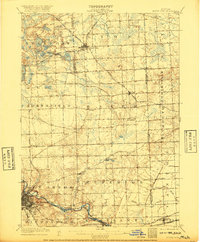
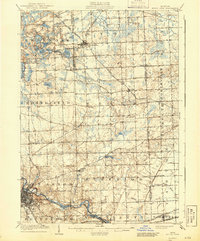
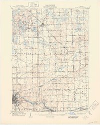
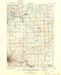
1906 Map of South Lyon
USGS Topo · Published 1906About this map
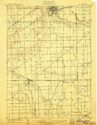
Ann Arbor anchors the southwestern corner of this survey, shown just as the regional rail network was at its peak. The city sits along the Huron River, with the Michigan Central River and Ann Arbor and Ypsilanti Electric RR providing vital connections to nearby Ypsilanti and Geddes. The landscape north of the city is a complex mix of glacial terrain and small farming communities such as Dixboro, Emery, and Worden.
Find a feature on this map
56 named features on this map. Tap any name to fly to it.
Don’t see what you’re looking for? This feature index may not catch every label — zoom into the map to look around manually.
Map Details
Editions of this 1906 South Lyon Map
5 editions found
Other maps of this area

1902 · South Lyon
USGS Topo · 1:62,500

1902 · Ypsilanti
USGS Topo · 1:62,500

1902 · Dexter
USGS Topo · 1:62,500

1904 · Ann Arbor
USGS Topo · 1:125,000

1905 · Wayne
USGS Topo · 1:62,500
1906 · Ypsilanti
USGS Topo · 1:62,500

1906 · Dexter
USGS Topo · 1:62,500

1906 · Saline
USGS Topo · 1:62,500

1906 · Romulus
USGS Topo · 1:62,500

1907 · Pontiac
USGS Topo · 1:62,500
Featured Places
- Ann Arbor, MI
- Canton Township, MI
- Novi, MI
- Ypsilanti Charter Township, MI
- Pittsfield Charter Township, MI