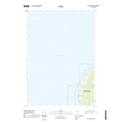
2019 Map of South Manitou Island
USGS Topo · Published 2019About this map
Sleeping Bear Dunes National Lakeshore dominates the southern reaches of this maritime survey, illustrating the protected coastal environment of South Manitou Island. Bordered by the expansive waters of Lake Michigan, the island's interior reveals a network of SMI Trails/Old Roads that trace the historical movement of residents and visitors across the dunes and through the forested tracts. These paths provide evidence of the island's past utility, likely serving former homesteads or navigation points before the land was integrated into the national lakeshore. The terrain is marked by significant elevation changes, with contours highlighting the distinctive dune formations along the western shoreline. This map captures the island in its modern state as a preserved wilderness, where historical transport routes have transitioned into a recreational trail system within the Michigan wilderness.
Find a feature on this map
5 named features on this map. Tap any name to fly to it.
Don’t see what you’re looking for? This feature index may not catch every label — zoom into the map to look around manually.
Map Details
Editions of this 2019 South Manitou Island Map
This is the sole edition of this map. No revisions or reprints were ever made.
Other maps of this area

1954 · Escanaba
USGS Topo · 1:250,000

1954 · Manitowoc
USGS Topo · 1:250,000

1956 · North Manitou
USGS Topo · 1:62,500

1957 · Escanaba
USGS Topo · 1:250,000

1957 · Empire
USGS Topo · 1:62,500

1958 · Escanaba
USGS Topo · 1:250,000

1958 · Manitowoc
USGS Topo · 1:250,000
1983 · Glen Haven
USGS Topo · 1:25,000
1983 · South Manitou Island
USGS Topo · 1:24,000

1984 · Washington Island
USGS Topo · 1:100,000