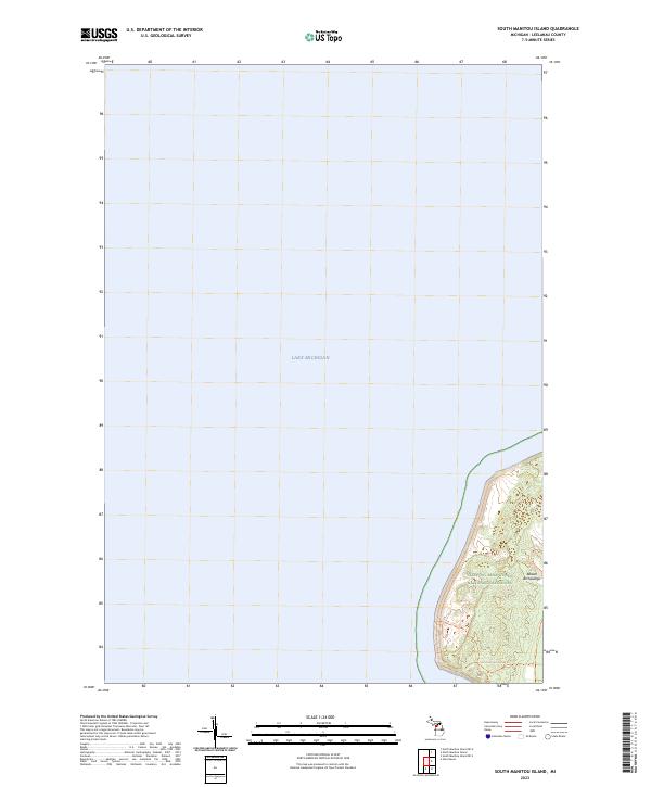
2023 Map of South Manitou Island
USGS Topo · Published 2023About this map
Lake Michigan surrounds the western edge of South Manitou Island, a significant feature of the Beaver Archipelago captured in this recent survey. Much of the island's landscape is dedicated to preservation within the Sleeping Bear Dunes Wilderness and the broader Sleeping Bear Dunes National Lakeshore. The topography is defined by the shifting sands and dunes characteristic of this region. Traces of human activity and island history are preserved in the form of Smi Trails/old Roads, which provide a record of travel patterns across the interior before modern conservation status limited development. This survey serves as a contemporary record of the island's shoreline and wilderness boundaries in Leelanau County.
Find a feature on this map
7 named features on this map. Tap any name to fly to it.
Don’t see what you’re looking for? This feature index may not catch every label — zoom into the map to look around manually.
Map Details
Editions of this 2023 South Manitou Island Map
This is the sole edition of this map. No revisions or reprints were ever made.
Other maps of this area

1954 · Escanaba
USGS Topo · 1:250,000

1954 · Manitowoc
USGS Topo · 1:250,000

1956 · North Manitou
USGS Topo · 1:62,500

1957 · Escanaba
USGS Topo · 1:250,000

1957 · Empire
USGS Topo · 1:62,500

1958 · Escanaba
USGS Topo · 1:250,000

1958 · Manitowoc
USGS Topo · 1:250,000
1983 · Glen Haven
USGS Topo · 1:25,000
1983 · South Manitou Island
USGS Topo · 1:24,000

1984 · Washington Island
USGS Topo · 1:100,000