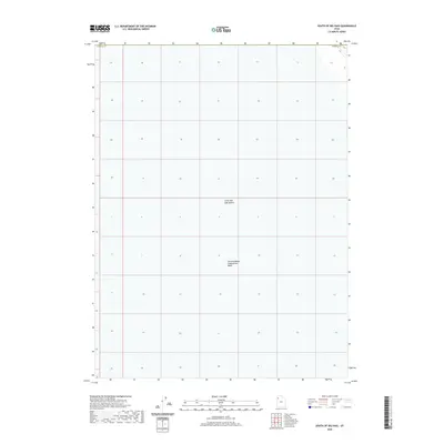
2020 Map of South of Big Pass
USGS Topo · Published 2020About this map
Great Salt Lake Desert dominates this 2020 landscape in western Tooele Co, Utah, providing a detailed look at one of the most desolate regions in the Great Basin. This high-resolution survey by the U.S. Geological Survey reveals the vast, flat expanses where salt crusts and seasonal water patterns define the geography. The most prominent feature on this sheet is the Newfoundland Evaporation Basin, a massive industrial or natural salt-harvesting feature that underscores the intersection of western mineral extraction and the unique hydrology of the salt flats. The map is primarily characterized by the Public Land Survey System (PLSS) grid, showing section lines across an area largely devoid of permanent human settlements or structures. It serves as a precise record of the topography and land boundaries within the desert floor during the early 21st century.
Find a feature on this map
3 named features on this map. Tap any name to fly to it.
Don’t see what you’re looking for? This feature index may not catch every label — zoom into the map to look around manually.
Map Details
Editions of this 2020 South of Big Pass Map
This is the sole edition of this map. No revisions or reprints were ever made.
Other maps of this area

1953 · Tooele
USGS Topo · 1:250,000

1954 · Brigham City
USGS Topo · 1:250,000

1955 · Tooele
USGS Topo · 1:250,000

1958 · Brigham City
USGS Topo · 1:250,000

1962 · Brigham City
USGS Topo · 1:250,000

1973 · Knolls 2 NW
USGS Topo · 1:24,000

1973 · Floating Island SE
USGS Topo · 1:24,000

1973 · Knolls 2 NE
USGS Topo · 1:24,000

1973 · Floating Island NE
USGS Topo · 1:24,000

1973 · Knolls 2 SW
USGS Topo · 1:24,000