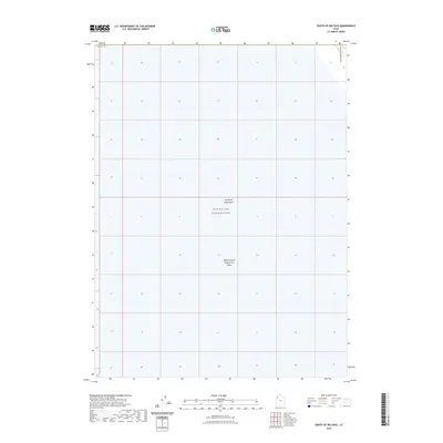
2023 Map of South of Big Pass
USGS Topo · Published 2023About this map
The Great Salt Lake Desert dominates this section of western Utah, presenting a landscape defined by expansive salt flats and military oversight. Within this territory lies the Utah Test and Training Range, a significant government installation that occupies a large portion of the desert floor. The map highlights the specialized industrial and hydrological use of the terrain, specifically the Newfoundland Evaporation Basin, which serves as a notable landmark for those studying the regional salt harvesting or water management history. On the eastern edge, the topography shifts slightly as the base of the Newfoundland Mountains enters the frame, providing the only significant elevation in an otherwise level expanse. This 2023 survey provides a clear view of the intersection between natural geological features and modern federal land utilization in Tooele County.
Find a feature on this map
5 named features on this map. Tap any name to fly to it.
Don’t see what you’re looking for? This feature index may not catch every label — zoom into the map to look around manually.
Map Details
Editions of this 2023 South of Big Pass Map
This is the sole edition of this map. No revisions or reprints were ever made.
Other maps of this area

1953 · Tooele
USGS Topo · 1:250,000

1954 · Brigham City
USGS Topo · 1:250,000

1955 · Tooele
USGS Topo · 1:250,000

1958 · Brigham City
USGS Topo · 1:250,000

1962 · Brigham City
USGS Topo · 1:250,000

1973 · Knolls 2 NW
USGS Topo · 1:24,000

1973 · Floating Island SE
USGS Topo · 1:24,000

1973 · Knolls 2 NE
USGS Topo · 1:24,000

1973 · Floating Island NE
USGS Topo · 1:24,000

1973 · Knolls 2 SW
USGS Topo · 1:24,000