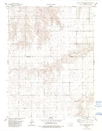
1978 Map of South of Crosby Creek
USGS Topo · Published 1993About this map
Benkelman and Grant townships meet along a high plateau in this mid-1970s survey of the High Plains. The landscape is defined by the incision of Little Beaver Creek, which carves a dendritic pattern through the agricultural terrain, flanked by numerous small draws. Human presence is sparse and largely centered on the Cheyenne Co Sherman Co line, which divides the northern and southern halves of the quadrangle. A solitary Neville Ch stands as a focal point for the local rural community, while a single Quarry in the northwest suggests localized industrial activity. The map reveals a highly structured grid of section lines and numerous water wells, essential for life in this arid Kansas environment.
Find a feature on this map
7 named features on this map. Tap any name to fly to it.
Don’t see what you’re looking for? This feature index may not catch every label — zoom into the map to look around manually.
Map Details
Editions of this 1978 South of Crosby Creek Map
3 editions found
Other maps of this area

1950 · Bonny Reservoir
USGS Topo · 1:62,500

1952 · St Francis 3
USGS Topo · 1:62,500

1954 · Limon
USGS Topo · 1:250,000

1954 · Goodland
USGS Topo · 1:250,000

1956 · Goodland
USGS Topo · 1:250,000

1957 · Limon
USGS Topo · 1:250,000

1957 · Goodland
USGS Topo · 1:250,000

1958 · Limon
USGS Topo · 1:250,000

1966 · Ruleton NW
USGS Topo · 1:24,000

1966 · Ruleton NE
USGS Topo · 1:24,000