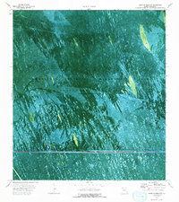
1973 Map of South of Deem City
USGS Topo · Published 1993About this map
The Everglades Wildlife Management Area and Conservation Area No 3A dominate this 1970s orthophotomap, revealing the intricate water management and transportation patterns of the Florida wetlands. Unlike traditional topographic maps, this image-based survey provides a direct look at the sawgrass and tree islands of the interior. Human activity is marked by a network of specialized routes, including the Airboat Weasel Trail and Airboat North Trail, which reflect the unique navigational requirements of this periodically impounded environment. Infrastructure like the Pipeline, a Toll Road, and the Mud Canal underscore the engineering efforts to control and utilize this landscape. A lone Gaging Sta stands as a point of data collection in an otherwise fluid terrain where water levels are the primary shaping force.
Find a feature on this map
10 named features on this map. Tap any name to fly to it.
Don’t see what you’re looking for? This feature index may not catch every label — zoom into the map to look around manually.
Map Details
Editions of this 1973 South of Deem City Map
2 editions found
Other maps of this area

1956 · West Palm Beach
USGS Topo · 1:250,000

1957 · West Palm Beach
USGS Topo · 1:250,000

1958 · West Palm Beach
USGS Topo · 1:250,000

1963 · Andytown
USGS Topo · 1:24,000

1963 · Cooper City SW
USGS Topo · 1:24,000

1973 · Everglades 4 NW
USGS Topo · 1:24,000

1973 · Everglades 4 NE
USGS Topo · 1:24,000

1973 · Everglades 4 SE
USGS Topo · 1:24,000

1973 · Fort Lauderdale 2 SW
USGS Topo · 1:24,000
1973 · Everglades 4 SW
USGS Topo · 1:24,000