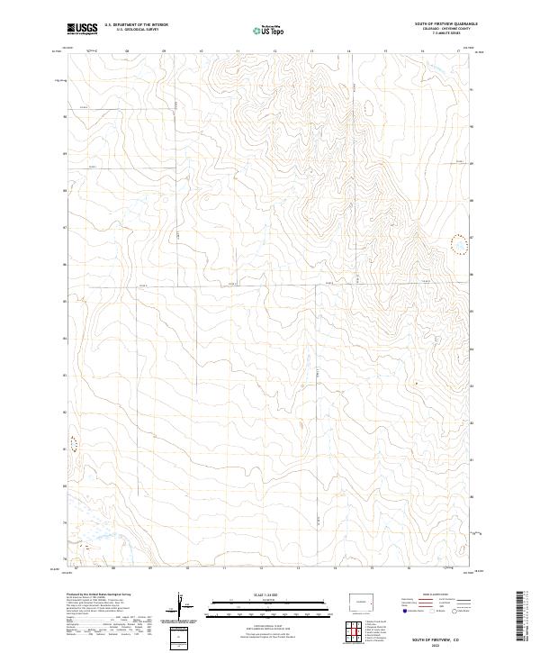
2022 Map of South of Firstview
USGS Topo · Published 2022About this map
Big Sandy Cr winds through the southwestern corner of this Colorado landscape, highlighting a region defined by the open drainage basins of the High Plains. This 2022 survey captures the grid of the Public Land Survey System, where townships like t15s r47w and t16s r46w organize the high desert terrain. In the northeast, the headwaters of S Ladder Cr begin their course, providing a contrast to the southern water systems. The map is primarily characterized by its lack of dense settlement, instead focusing on the essential rural infrastructure and section lines that define Cheyenne County property and transit, such as Co Rd K.
Find a feature on this map
8 named features on this map. Tap any name to fly to it.
Don’t see what you’re looking for? This feature index may not catch every label — zoom into the map to look around manually.
Map Details
Editions of this 2022 South of Firstview Map
This is the sole edition of this map. No revisions or reprints were ever made.
Other maps of this area

1891 · Kit Carson
USGS Topo · 1:125,000

1892 · Cheyenne Wells
USGS Topo · 1:125,000

1893 · Kit Carson
USGS Topo · 1:125,000

1894 · Cheyenne Wells
USGS Topo · 1:125,000

1954 · Lamar
USGS Topo · 1:250,000

1958 · Lamar
USGS Topo · 1:250,000

1981 · Cheyenne Wells
USGS Topo · 1:100,000
1982 · Kit Carson 4 SE
USGS Topo · 1:24,000

1982 · Cheyenne Wells SW
USGS Topo · 1:24,000

1982 · Kit Carson 4 NE
USGS Topo · 1:24,000