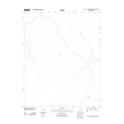
2012 Map of South of Gregerson Basin
USGS Topo · Published 2012About this map
Kane Springs Valley defines the arid character of this high desert terrain in southeastern Nevada, documented here in a 2012 survey. Water management is the primary marker of human presence and land use in this sparsely populated region, as seen through the distribution of reservoirs and natural water sources. Pony Reservoir sits at the northern edge of the sheet, while the central landscape features Pocket Number Three Reservoir and Gregerson Basin Number Two. These infrastructure points, alongside the Wire Grass Spring, provide essential hydration points for the basin's livestock and local wildlife, revealing the vital importance of seasonal water storage in the high-elevation flats of Lincoln County.
Find a feature on this map
5 named features on this map. Tap any name to fly to it.
Don’t see what you’re looking for? This feature index may not catch every label — zoom into the map to look around manually.
Map Details
Editions of this 2012 South of Gregerson Basin Map
This is the sole edition of this map. No revisions or reprints were ever made.
Other maps of this area

1885 · Pioche
USGS Topo · 1:250,000

1886 · Pioche
USGS Topo · 1:250,000

1954 · Caliente
USGS Topo · 1:250,000

1959 · Caliente
USGS Topo · 1:250,000

1969 · Vigo NW
USGS Topo · 1:24,000
1969 · Delamar 3 SE
USGS Topo · 1:24,000

1969 · Gregerson Basin
USGS Topo · 1:24,000

1969 · Delamar 3 NE
USGS Topo · 1:24,000
1969 · Delamar 3 SW
USGS Topo · 1:24,000
1969 · Sunflower Mtn
USGS Topo · 1:24,000