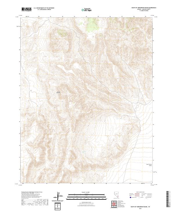
2021 Map of South of Gregerson Basin
USGS Topo · Published 2021About this map
Wire Grass Spring provides a rare point of named hydrography in this high desert landscape, located deep within the Delamar Mountains. This 2021 survey by the U.S. Geological Survey shows a terrain of extreme verticality, where the western ridgelines eventually give way to the broad, flat expanse of the Kane Springs Valley in the southeast. The map is defined by its complex contour patterns, illustrating the rugged geological character of this part of Lincoln County. The vast majority of the quadrangle is undeveloped mountain country, with the land divided by the Public Land Survey System into townships such as t8s r64e and t9s r64e. The transition from the steep Delamar range to the valley floor reflects the classic basin-and-range geography of southern Nevada.
Find a feature on this map
9 named features on this map. Tap any name to fly to it.
Don’t see what you’re looking for? This feature index may not catch every label — zoom into the map to look around manually.
Map Details
Editions of this 2021 South of Gregerson Basin Map
This is the sole edition of this map. No revisions or reprints were ever made.
Other maps of this area

1885 · Pioche
USGS Topo · 1:250,000

1886 · Pioche
USGS Topo · 1:250,000

1954 · Caliente
USGS Topo · 1:250,000

1959 · Caliente
USGS Topo · 1:250,000

1969 · Vigo NW
USGS Topo · 1:24,000
1969 · Delamar 3 SE
USGS Topo · 1:24,000

1969 · Gregerson Basin
USGS Topo · 1:24,000

1969 · Delamar 3 NE
USGS Topo · 1:24,000
1969 · Delamar 3 SW
USGS Topo · 1:24,000
1969 · Sunflower Mtn
USGS Topo · 1:24,000