
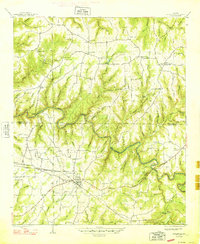
1936 Map of South Of Hackleburg
USGS Topo · Published 1936About this map
The Tennessee Valley Authority and U.S. Geological Survey collaborated on this 1936 advance sheet, focusing on the drainage landscape south of the town of Hackleburg. Compiled from aerial photographs and verified by field examination, the map illustrates the local hydrology where Brush Creek feeds into the Tennessee river system. The terrain is defined by a central Basin and a prominent ridge line labeled simply as the Divide, which separates the local water flow. This document captures the initial topographic control and surveying effort during the active era of development in Marion County.
Find a feature on this map
4 named features on this map. Tap any name to fly to it.
Don’t see what you’re looking for? This feature index may not catch every label — zoom into the map to look around manually.
Map Details
Editions of this 1936 South Of Hackleburg Map
This is the sole edition of this map. No revisions or reprints were ever made.
Other maps of this area

1936 · Hodges
USGS Topo · 1:24,000

1936 · Phil Campbell
USGS Topo · 1:24,000

1936 · Hackleburg
USGS Topo · 1:24,000

1936 · Goddard
USGS Topo · 1:24,000

1946 · Hackleburg
USGS Topo · 1:24,000

1946 · Phil Campbell
USGS Topo · 1:24,000

1947 · Phil Campbell
USGS Topo · 1:24,000
1948 · Hackleburg
USGS Topo · 1:24,000

1949 · Hodges
USGS Topo · 1:24,000

1956 · Gadsden
USGS Topo · 1:250,000