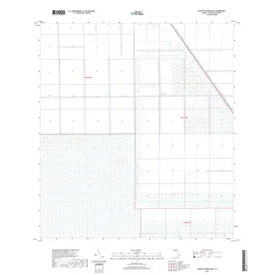
2018 Map of South of Okeelanta
USGS Topo · Published 2018About this map
The Everglades dominate this 2018 survey of Palm Beach County, showing the intricate relationship between the natural wetlands and the managed agricultural landscape of South Florida. The vast expanse is bisected by the North New River Canal, a vital piece of the region's historical water management infrastructure that runs diagonally through the northeastern corner. The map reflects a highly structured terrain, where the wild character of the glades meets the rigid grid of the Public Land Survey System, as seen in the boundaries for T46s R36e, T46s R37e, and T47s R37e. This modern document records the contemporary state of the Southern Everglades, serving as a baseline for understanding how twentieth-century drainage and land-use policies have shaped this specific quadrant of the Florida peninsula.
Find a feature on this map
7 named features on this map. Tap any name to fly to it.
Don’t see what you’re looking for? This feature index may not catch every label — zoom into the map to look around manually.
Map Details
Editions of this 2018 South of Okeelanta Map
This is the sole edition of this map. No revisions or reprints were ever made.
Other maps of this area

1956 · West Palm Beach
USGS Topo · 1:250,000

1957 · West Palm Beach
USGS Topo · 1:250,000

1958 · West Palm Beach
USGS Topo · 1:250,000

1970 · Lake Harbor SE
USGS Topo · 1:24,000

1970 · Okeelanta
USGS Topo · 1:24,000

1970 · Shawano
USGS Topo · 1:24,000

1974 · Everglades 1 SW
USGS Topo · 1:24,000

1974 · Everglades 2 SE
USGS Topo · 1:24,000

1974 · Everglades 1 NW
USGS Topo · 1:24,000

1974 · Everglades 1 SE
USGS Topo · 1:24,000