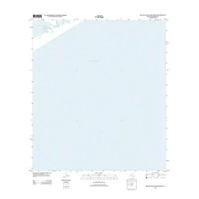
2013 Map of South of Palacios Point
USGS Topo · Published 2013About this map
Gulf of Mexico waters dominate this coastal survey at the threshold of the Texas coastline. The map focuses on the marine environment south of the mainland, where the open sea meets the sheltered waters of Matagorda Bay. The northernmost edge of the sheet captures a small fragment of the shoreline, defined by the mouth of Greens Bayou. This area is a critical maritime junction where tidal exchange occurs between the expansive bay system and the open gulf. The lack of terrestrial infrastructure or settlements underscores the environmental focus of this survey, prioritizing the mapping of bathymetric transitions and coastal hydrography along this section of Matagorda County.
Find a feature on this map
3 named features on this map. Tap any name to fly to it.
Don’t see what you’re looking for? This feature index may not catch every label — zoom into the map to look around manually.
Map Details
Editions of this 2013 South of Palacios Point Map
This is the sole edition of this map. No revisions or reprints were ever made.
Other maps of this area

1952 · Palacios SE
USGS Topo · 1:24,000

1952 · Palacios Point
USGS Topo · 1:24,000

1952 · South of Palacios Point
USGS Topo · 1:24,000

1952 · Decros Point
USGS Topo · 1:24,000

1953 · Beeville
USGS Topo · 1:250,000

1956 · Beeville
USGS Topo · 1:250,000

1960 · Beeville
USGS Topo · 1:250,000
1980 · Carancahua Pass
USGS Topo · 1:24,000
1983 · San Antonio Bay
USGS Topo · 1:100,000
1984 · Port Lavaca
USGS Topo · 1:100,000